Roofs have a special impact on the image of our towns and settlements. Historic roofs contribute to the value of numerous buildings as a testimony to our culture and history. At the same time, it can be observed that roofs in particular are subject to considerable changes, so that historic constructions and roof coverings are often lost during renovations, extensions or conversions. The use of listed roofs to generate energy with solar systems has recently increased the pressure to modify historic roofs. This represents a major challenge for monument protection and requires extensive knowledge of the roofs.
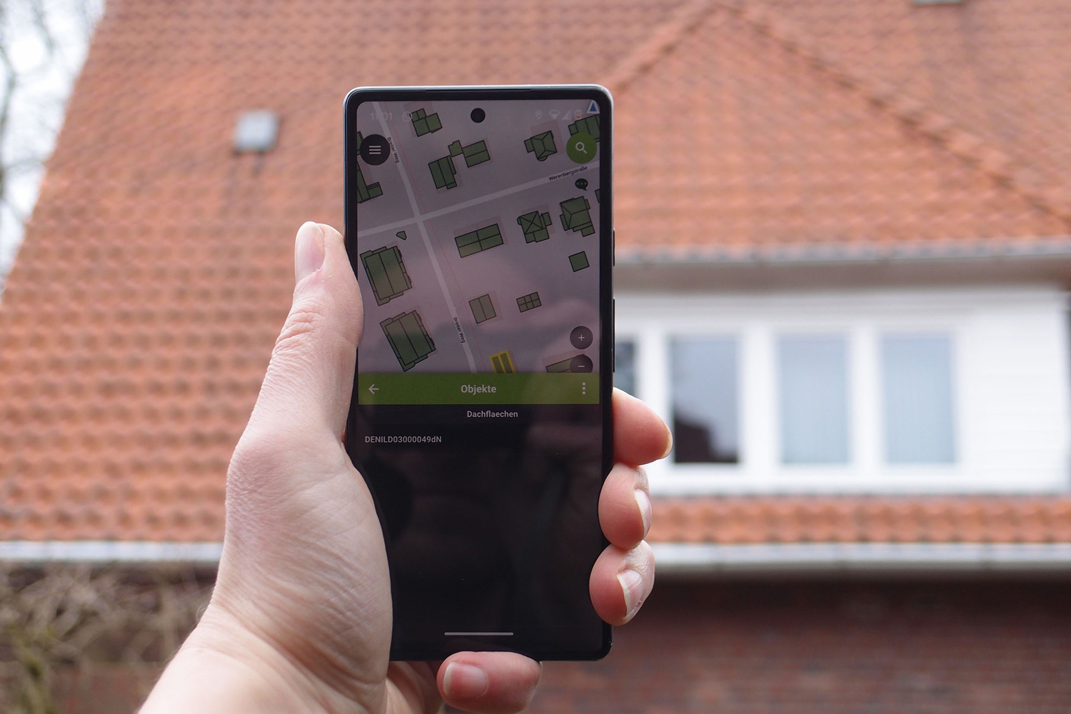
As part of the research project “Ressource Denkmal-Dach”, the Lower Saxony State Office for Monument Preservation and the Institute for Geodesy and Photogrammetry at the Technical University of Braunschweig are developing an automated process for creating a roof cadastre which, in addition to information on solar potential, also takes into account criteria for monument preservation. In particular, it should contain information on materials and roof coverings and determine the visibility of the roof surfaces in public spaces.
Such a tool can enable a more differentiated assessment of the suitability of listed buildings for solar installations and thus provide initial guidance or help to prioritize construction projects. However, it also provides valuable information about the listed building stock as a whole, such as the occurrence and distribution of rare roof coverings or the proportion of certain roof shapes.
The project aims to lay the technical and methodological foundations for obtaining the necessary information from aerial images, laser scan data and 3D models, evaluating it with the help of neural networks (deep learning) and assessing it according to monument preservation criteria. For this purpose, analysis methods of geoinformatics are combined with the criteria of monument preservation and the knowledge of building history.
The roof information included in the cadastre is the result of an automated process consisting of a series of specific analysis steps: Analysis of solar potential, visibility, materiality and heritage value. Each step either leads to a new data set or generates the parameter values for a roof area. The final process combines these parameters to produce the overall result. Finally, the data can be made publicly accessible in the Denkmalatlas Niedersachsen (Lower Saxony Monument Atlas) and should help to increase knowledge of the existing monument stock and improve the development of the stock in line with monument requirements in practice.
Project partners
- Niedersächsisches Landesamt für Denkmalpflege
- Institut für Geodäsie und Photogrammetrie, Technische Universität Braunschweig
Sponsor
- Förderreihe PRO*Niedersachsen
- Gefördert durch Mittel aus SPRUNG